


le mesnil

dedejojo
User
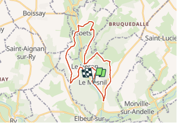

Length
15.2 km

Max alt
170 m

Uphill gradient
353 m
Km-Effort
19.9 km

Min alt
78 m

Downhill gradient
353 m
Boucle
Yes
Creation date :
2021-10-24 08:30:50.648
Updated on :
2021-10-24 13:34:45.087
5h02
Difficulty : Very easy

FREE GPS app for hiking
 SityTrail
IGN / Geographical institutes
SityTrail Plus
The world is yours!
About
Trail Walking of 15.2 km to be discovered at Normandy, Seine-Maritime, Le Héron. This trail is proposed by dedejojo.
Positioning
Country:
France
Region :
Normandy
Department/Province :
Seine-Maritime
Municipality :
Le Héron
Location:
Unknown
Start:(Dec)
Start:(UTM)
384085 ; 5482953 (31U) N.
Comments